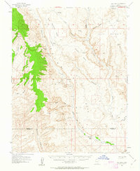
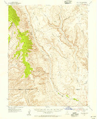
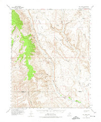
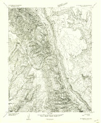
1953 Map of Hall Mesa
USGS Topo · Published 1963About this map
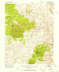
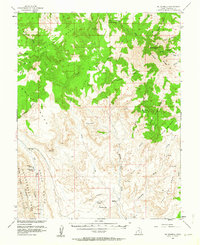
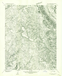
Circle Cliffs dominate the western landscape of this mid-century survey, where the dramatic elevation changes of the Colorado Plateau create a complex network of canyons and mesas. Remote ranching and early petroleum exploration define the human presence here, anchored by Baker Ranch along the banks of Baker Creek. A small Landing Strip and an Oil Well (Aban'd) near Middle Point speak to the era's industrial interests in the canyon country. Navigation through the region relies on primitive routes like the Jeep Trail crossing Hall Divide, which connects the high ground of Hall Mesa to the drainage of Halls Creek. The intricate topography includes significant landmarks like Clay Point and Saleratus Point, illustrating the stark geology of the Garfield and Kane County borderlands before modern development reached this part of southern Utah.
Find a feature on this map
34 named features on this map. Tap any name to fly to it.
Don’t see what you’re looking for? This feature index may not catch every label — zoom into the map to look around manually.
Map Details
Editions of this 1953 Hall Mesa Map
4 editions found

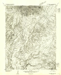
Other maps of this area

1886 · Escalante
USGS Topo · 1:250,000

1886 · Henry Mountains
USGS Topo · 1:250,000

1892 · Henry Mountains
USGS Topo · 1:250,000
1952 · Mt Pennell 1 SW
USGS Topo · 1:24,000
1952 · Mt Hillers
USGS Topo · 1:62,500
1953 · Mt Pennell
USGS Topo · 1:62,500
1953 · Circle Cliffs 1 SE
USGS Topo · 1:24,000
1953 · Mt Pennell 2 SE
USGS Topo · 1:24,000
1953 · Mt Pennell 3 NW
USGS Topo · 1:24,000
1953 · Mt Pennell 3 SW
USGS Topo · 1:24,000