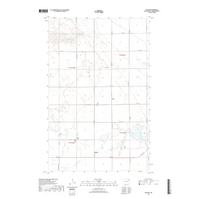
2017 Map of Hallson
USGS Topo · Published 2017About this map
The Tongue River meanders through this portion of Pembina County, defining a landscape of agricultural sections and water drainage features. The small settlements of Hallson and Svold anchor the local geography, connected by a network of rural roads like 93rd St NE and 133rd Ave NE. For genealogists and local historians, the presence of several distinct burial sites provides significant research value, including the Hallson Cem, Andvari Cem, Peters Cem, and the Old Peters Cem. This pattern of multiple small cemeteries often points to early ethnic settlement clusters or family landholdings. To the east, the terrain opens into Lake Renwick, while the northern reaches feature Rosa Lake and the subtle drainage paths of Smith Coulee and Busse Coulee.
Find a feature on this map
30 named features on this map. Tap any name to fly to it.
Don’t see what you’re looking for? This feature index may not catch every label — zoom into the map to look around manually.
Map Details
Editions of this 2017 Hallson Map
This is the sole edition of this map. No revisions or reprints were ever made.
Other maps of this area

1918 · Walhalla
USGS Topo · 1:62,500

1939 · Cavalier
USGS Topo · 1:62,500

1941 · Cavalier
USGS Topo · 1:62,500

1943 · Walhalla
USGS Topo · 1:62,500

1944 · Crystal
USGS Topo · 1:62,500

1952 · Thief River Falls
USGS Topo · 1:250,000

1956 · Thief River Falls
USGS Topo · 1:250,000

1957 · Thief River Falls
USGS Topo · 1:250,000

1964 · Mountain
USGS Topo · 1:24,000
1964 · Hensel
USGS Topo · 1:24,000