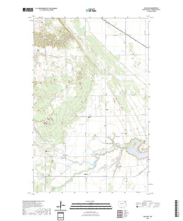
2024 Map of Hallson
USGS Topo · Published 2024About this map
Svold and Hallson anchor this rural landscape in Pembina County, representing the small, tight-knit communities that define the agricultural history of northeastern North Dakota. The Tongue River meanders across the southern sections of the map, joined by tributaries such as Smith Coulee and Busse Coulee, which shape the local drainage and topography. This area is characterized by its organized section grid, a fundamental element of the Public Land Survey System that dictates the placement of farmsteads and transport routes.
Find a feature on this map
28 named features on this map. Tap any name to fly to it.
Don’t see what you’re looking for? This feature index may not catch every label — zoom into the map to look around manually.
Map Details
Editions of this 2024 Hallson Map
This is the sole edition of this map. No revisions or reprints were ever made.
Other maps of this area

1918 · Walhalla
USGS Topo · 1:62,500

1939 · Cavalier
USGS Topo · 1:62,500

1941 · Cavalier
USGS Topo · 1:62,500

1943 · Walhalla
USGS Topo · 1:62,500

1944 · Crystal
USGS Topo · 1:62,500

1952 · Thief River Falls
USGS Topo · 1:250,000

1956 · Thief River Falls
USGS Topo · 1:250,000

1957 · Thief River Falls
USGS Topo · 1:250,000

1964 · Mountain
USGS Topo · 1:24,000
1964 · Hensel
USGS Topo · 1:24,000