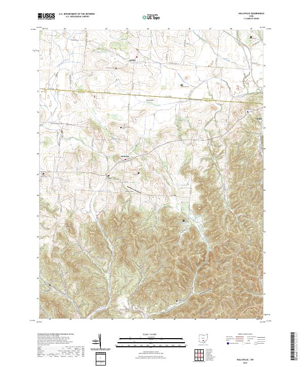
2023 Map of Hallsville
USGS Topo · Published 2023About this map
The crossroads of Hallsville and Whisler anchor the rolling landscape at the edge of the Tar Hollow State Forest. This detailed 2023 survey delineates the agrarian and wooded transition between the level expanse of The Prairie and the carved terrain of Rock Hill and Brush Ridge. Genealogists will find a high concentration of family and community burial grounds, including the Throckmorton Cem, Maple Grove Cem, and Salem Reform Cem, which offer physical links to the early families of the Ross and Pickaway county line. The drainage patterns of Salt Creek and Kinnikinnick Creek define the local topography, while landmarks like Mission Field and the notable elevation of Jobs Knob provide distinct points of reference in a region defined by its narrow hollows, such as Slickaway Hollow and Butcher Hollow.
Find a feature on this map
85 named features on this map. Tap any name to fly to it.
Don’t see what you’re looking for? This feature index may not catch every label — zoom into the map to look around manually.
Map Details
Editions of this 2023 Hallsville Map
This is the sole edition of this map. No revisions or reprints were ever made.
Other maps of this area

1906 · Chillicothe
USGS Topo · 1:62,500

1907 · Lancaster
USGS Topo · 1:62,500

1908 · Chillicothe
USGS Topo · 1:62,500

1909 · Lancaster
USGS Topo · 1:62,500

1910 · Laurelville
USGS Topo · 1:62,500

1912 · Laurelville
USGS Topo · 1:62,500

1914 · Circleville
USGS Topo · 1:62,500

1943 · Circleville
USGS Topo · 1:62,500

1944 · Laurelville
USGS Topo · 1:62,500

1947 · Columbus
USGS Topo · 1:250,000