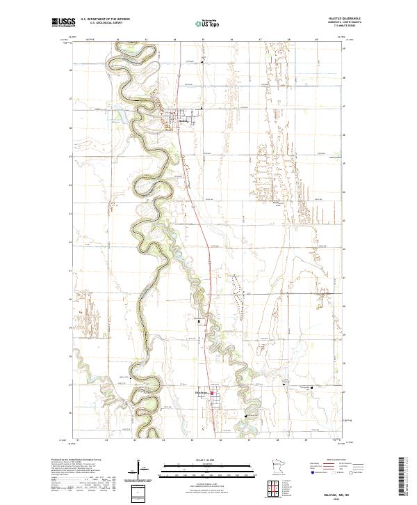
2022 Map of Halstad
USGS Topo · Published 2022About this map
The Red River of the North carves a complex, winding path through this fertile stretch of the Red River Valley, defining the border between North Dakota and Minnesota. The settlement of Halstad serves as a primary hub in this agricultural landscape, situated just east of the river's loops. To the south, Hendrum marks another center of activity near the confluence where the Wild Rice River joins the larger river system.
Find a feature on this map
38 named features on this map. Tap any name to fly to it.
Don’t see what you’re looking for? This feature index may not catch every label — zoom into the map to look around manually.
Map Details
Editions of this 2022 Halstad Map
This is the sole edition of this map. No revisions or reprints were ever made.
Other maps of this area

1918 · Hendrum
USGS Topo · 1:62,500

1924 · Ada
USGS Topo · 1:62,500

1952 · Grand Forks
USGS Topo · 1:250,000

1956 · Grand Forks
USGS Topo · 1:250,000

1963 · Shelly
USGS Topo · 1:24,000

1963 · Perley
USGS Topo · 1:24,000

1963 · Gardner
USGS Topo · 1:24,000

1963 · Halstad
USGS Topo · 1:24,000

1963 · Halstad SW
USGS Topo · 1:24,000
1964 · Caledonia
USGS Topo · 1:24,000