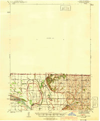
1941 Map of Hamburg
USGS Topo · Published 1941About this map
The Missouri River and its intricate network of former channels define this tri-state boundary region, where the lines of Iowa, Missouri, and Nebraska converge. The 1939 survey reveals a landscape of shifting silt and floodplains, most notably McKissock Island, which became geographically separated from its parent state of Nebraska by the river's changing course. This alluvial plain is crisscrossed by the Chicago Burlington and Quincy railroad, which supported a dense network of rural school districts and community anchors.
Find a feature on this map
43 named features on this map. Tap any name to fly to it.
Don’t see what you’re looking for? This feature index may not catch every label — zoom into the map to look around manually.
Map Details
Editions of this 1941 Hamburg Map
2 editions found

Other maps of this area

1907 · Nebraska City
USGS Topo · 1:62,500

1915 · Nemaha
USGS Topo · 1:62,500

1915 · Howe
USGS Topo · 1:62,500

1935 · Nehawka
USGS Topo · 1:48,000

1939 · Tarkio
USGS Topo · 1:62,500

1939 · Farragut
USGS Topo · 1:62,500

1939 · Hamburg
USGS Topo · 1:62,500

1939 · Nemaha
USGS Topo · 1:62,500

1940 · Tarkio
USGS Topo · 1:62,500

1940 · Farragut
USGS Topo · 1:62,500