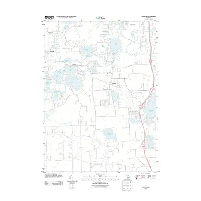
2011 Map of Hamburg
USGS Topo · Published 2011About this map
Strawberry Lake and the Huron River system anchor this landscape in the early twenty-first century, revealing a region defined by its glacial hydrology. The community of Hamburg sits at the heart of a dense network of water bodies, including Zukey Lake, Ore Lake, and Winans Lake. These lakes are joined by smaller creeks like Arms Creek and South Ore Creek, illustrating how the natural topography has shaped the residential and recreational patterns of Livingston County.
Find a feature on this map
134 named features on this map. Tap any name to fly to it.
Don’t see what you’re looking for? This feature index may not catch every label — zoom into the map to look around manually.
Map Details
Editions of this 2011 Hamburg Map
This is the sole edition of this map. No revisions or reprints were ever made.
Other maps of this area

1902 · South Lyon
USGS Topo · 1:62,500

1902 · Dexter
USGS Topo · 1:62,500

1904 · Ann Arbor
USGS Topo · 1:125,000

1906 · Dexter
USGS Topo · 1:62,500

1906 · South Lyon
USGS Topo · 1:62,500

1907 · Howell
USGS Topo · 1:62,500

1908 · Ann Arbor
USGS Topo · 1:125,000

1909 · Howell
USGS Topo · 1:62,500

1909 · Milford
USGS Topo · 1:62,500

1954 · Detroit
USGS Topo · 1:250,000
Featured Places
- Hamburg Township, MI
- Green Oak Charter Township, MI
- Northfield Township, MI
- Webster Township, MI
- Hamburg, Hamburg Township