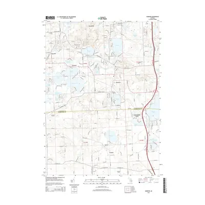
2014 Map of Hamburg
USGS Topo · Published 2014About this map
The Huron River winds through a dense network of glacial lakes in this southern Michigan landscape, defining the character of Hamburg and Lakeland. This 2014 survey captures a region defined by its waterfront geography, where communities like Whitmore Lake and Parishfield are surrounded by prominent water bodies including Strawberry Lake, Zukey Lake, and Independence Lake. The transition between Livingston and Washtenaw counties is marked by a mix of residential expansion and preserved open space, with aviation history represented by the small runways of Cackleberry Airport and Gooding Airport. For those researching local family history, several burial grounds are documented across the township, including N Hamburg Cem near the northern border and the Hamburg Village Cem near the town center. The map also traces established road corridors like M-36 and N Territorial Rd that connect these lakeside settlements.
Find a feature on this map
103 named features on this map. Tap any name to fly to it.
Don’t see what you’re looking for? This feature index may not catch every label — zoom into the map to look around manually.
Map Details
Editions of this 2014 Hamburg Map
This is the sole edition of this map. No revisions or reprints were ever made.
Other maps of this area

1902 · South Lyon
USGS Topo · 1:62,500

1902 · Dexter
USGS Topo · 1:62,500

1904 · Ann Arbor
USGS Topo · 1:125,000

1906 · Dexter
USGS Topo · 1:62,500

1906 · South Lyon
USGS Topo · 1:62,500

1907 · Howell
USGS Topo · 1:62,500

1908 · Ann Arbor
USGS Topo · 1:125,000

1909 · Howell
USGS Topo · 1:62,500

1909 · Milford
USGS Topo · 1:62,500

1954 · Detroit
USGS Topo · 1:250,000
Featured Places
- Hamburg Township, MI
- Green Oak Charter Township, MI
- Northfield Township, MI
- Webster Township, MI
- Hamburg, Hamburg Township