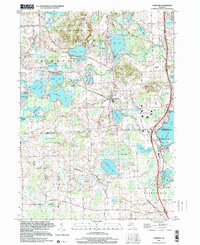
1996 Map of Hamburg
USGS Topo · Published 2000About this map
The Huron River winds through this lake-rich landscape along the boundary of Livingston and Washtenaw Counties, serving as the central drainage for an intricate chain of waters including Strawberry Lake, Zukey Lake, and Ore Lake. This late 20th-century survey shows the dense cluster of settlements at Hamburg and Lakeland, where residential growth is bounded by large institutional and recreational tracts. The northern portion is dominated by the Brighton State Recreation Area, while to the south, the terrain transitions into the agricultural and residential patterns of Webster and Northfield. Distinctive local landmarks such as the Boys Training Camp near Hamburg Lake and St Benedicts Novitiate reflect the diverse historical uses of the lakefront properties. Transportation history is visible in the remaining Railroad Grade and the grid of rural roads like North Territorial Road, which helped shape the development of these vacation and commuter communities.
Find a feature on this map
63 named features on this map. Tap any name to fly to it.
Don’t see what you’re looking for? This feature index may not catch every label — zoom into the map to look around manually.
Map Details
Editions of this 1996 Hamburg Map
This is the sole edition of this map. No revisions or reprints were ever made.
Other maps of this area

1902 · South Lyon
USGS Topo · 1:62,500

1902 · Dexter
USGS Topo · 1:62,500

1904 · Ann Arbor
USGS Topo · 1:125,000

1906 · Dexter
USGS Topo · 1:62,500

1906 · South Lyon
USGS Topo · 1:62,500

1907 · Howell
USGS Topo · 1:62,500

1908 · Ann Arbor
USGS Topo · 1:125,000

1909 · Howell
USGS Topo · 1:62,500

1909 · Milford
USGS Topo · 1:62,500

1954 · Detroit
USGS Topo · 1:250,000
Featured Places
- Hamburg Township, MI
- Green Oak Charter Township, MI
- Northfield Township, MI
- Webster Township, MI
- Hamburg, Hamburg Township