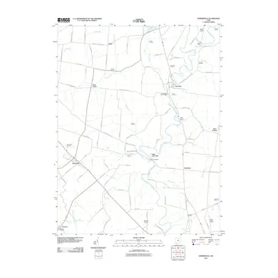
2010 Map of Hamersville
USGS Topo · Published 2010About this map
Hamersville and New Hope anchor this Brown County landscape, where small crossroads settlements and family burial grounds are linked by a dense network of country roads. The hydrology of the region is defined by the winding course of White Oak Creek and its many tributaries, including Sterling Run and Unity Creek. Significant local landmarks include the Grant Lake Dam and several historic places of worship and rest, such as Browns Chapel and the Wardlow Cemetery.
Find a feature on this map
93 named features on this map. Tap any name to fly to it.
Don’t see what you’re looking for? This feature index may not catch every label — zoom into the map to look around manually.
Map Details
Editions of this 2010 Hamersville Map
This is the sole edition of this map. No revisions or reprints were ever made.
Other maps of this area

1914 · Batavia
USGS Topo · 1:48,000

1916 · Batavia
USGS Topo · 1:62,500

1917 · Sardinia
USGS Topo · 1:62,500

1928 · Higginsport
USGS Topo · 1:48,000

1931 · Felicity
USGS Topo · 1:62,500

1931 · Higginsport
USGS Topo · 1:62,500

1944 · Sardinia
USGS Topo · 1:62,500

1947 · Columbus
USGS Topo · 1:250,000

1952 · Higginsport
USGS Topo · 1:24,000

1953 · Bethel
USGS Topo · 1:24,000