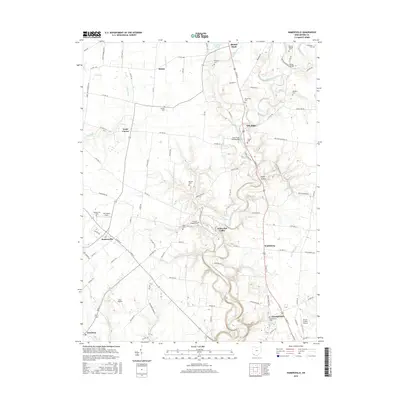
2016 Map of Hamersville
USGS Topo · Published 2016About this map
White Oak Creek and its many tributaries, including Snapping Turtle Run and Walnut Cr, carve a winding path through this portion of Brown County. The landscape is defined by its agricultural character and scattered small communities such as Hamersville, Shiloh, and Wahlsburg. Genealogists will find a wealth of burial sites mapped across the townships, from the centrally located Farmers Chapel Cem to Confidence Cem near Georgetown. The local infrastructure is further evidenced by aviation landmarks like Elbel Airport and Brown County Airport, alongside recreation at Grant Lake in the north. This survey illustrates the persistent rural fabric of southern Ohio, where many family-named landmarks like Warner Cem and Ralston Cem remain preserved alongside modern state and county thoroughfares.
Find a feature on this map
106 named features on this map. Tap any name to fly to it.
Don’t see what you’re looking for? This feature index may not catch every label — zoom into the map to look around manually.
Map Details
Editions of this 2016 Hamersville Map
This is the sole edition of this map. No revisions or reprints were ever made.
Other maps of this area

1914 · Batavia
USGS Topo · 1:48,000

1916 · Batavia
USGS Topo · 1:62,500

1917 · Sardinia
USGS Topo · 1:62,500

1928 · Higginsport
USGS Topo · 1:48,000

1931 · Felicity
USGS Topo · 1:62,500

1931 · Higginsport
USGS Topo · 1:62,500

1944 · Sardinia
USGS Topo · 1:62,500

1947 · Columbus
USGS Topo · 1:250,000

1952 · Higginsport
USGS Topo · 1:24,000

1953 · Bethel
USGS Topo · 1:24,000