2023 Map of Hamersville
USGS Topo · Published 2023About this map
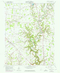
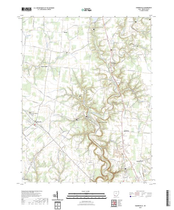
White Oak Creek meanders through the central landscape of this Brown County region, defining the drainage patterns for numerous tributaries like Sterling Run and Unity Creek. The settlement of Hamersville serves as a primary hub in the west, anchored by McKinney Field and the Hamersville Cem, while Georgetown sits at the southeastern edge near the Brown County Airport. This survey provides a modern view of rural Ohio's enduring community structure, where small clusters like Shiloh, Neals Corner, and New Hope remain connected by a dense network of county and township roads. Genealogists will find a high density of burial sites preserved in the landscape, including the Wardlow Cem in the northeast and Confidence Cem near the southern border, reflecting the deep-rooted family histories of the area. The terrain is further characterized by distinct natural features such as Stony Hollow and Shot Pouch Run, which highlight the dissected topography of the Ohio River Valley hinterlands.
Find a feature on this map
107 named features on this map. Tap any name to fly to it.
Don’t see what you’re looking for? This feature index may not catch every label — zoom into the map to look around manually.
Map Details
Editions of this 2023 Hamersville Map
This is the sole edition of this map. No revisions or reprints were ever made.