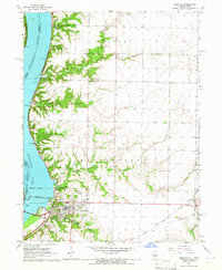
1964 Map of Hamilton
USGS Topo · Published 1965About this map
The Mississippi River defines the western edge of this 1960s landscape, where the massive Keokuk Dam and its associated infrastructure—including a substation, waterworks, and sewage disposal plant—anchor the industrial identity of Hamilton. This era shows a community deeply tied to both water and rail, with the Chicago Burlington and Quincy and the Toledo Peoria and Wabash Western railroads converging near the riverfront.
Find a feature on this map
36 named features on this map. Tap any name to fly to it.
Don’t see what you’re looking for? This feature index may not catch every label — zoom into the map to look around manually.
Map Details
Editions of this 1964 Hamilton Map
2 editions found
Other maps of this area

1932 · Lomax
USGS Topo · 1:62,500

1933 · Carthage
USGS Topo · 1:62,500

1936 · Keokuk
USGS Topo · 1:62,500

1936 · Fort Madison
USGS Topo · 1:62,500

1937 · Carthage
USGS Topo · 1:62,500

1937 · Lomax
USGS Topo · 1:62,500

1950 · Keokuk
USGS Topo · 1:62,500

1958 · Burlington
USGS Topo · 1:250,000

1961 · Burlington
USGS Topo · 1:250,000

1963 · Burlington
USGS Topo · 1:250,000