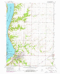
1964 Map of Hamilton
USGS Topo · Published 1977About this map
The Mississippi River defines the western edge of this landscape, where the massive Keokuk Dam and Lock No 19 facilitate river navigation and industrial power. The city of Hamilton serves as a vital transportation hub, marked by a Toll Bridge crossing into Iowa and the convergence of several major rail lines, including the Toledo Peoria and Western Railroad and the Norfolk and Western. This 1960s survey, updated with mid-1970s aerial data, reveals a community balancing river-based industry with traditional agriculture.
Find a feature on this map
43 named features on this map. Tap any name to fly to it.
Don’t see what you’re looking for? This feature index may not catch every label — zoom into the map to look around manually.
Map Details
Editions of this 1964 Hamilton Map
2 editions found
Other maps of this area

1932 · Lomax
USGS Topo · 1:62,500

1933 · Carthage
USGS Topo · 1:62,500

1936 · Keokuk
USGS Topo · 1:62,500

1936 · Fort Madison
USGS Topo · 1:62,500

1937 · Carthage
USGS Topo · 1:62,500

1937 · Lomax
USGS Topo · 1:62,500

1950 · Keokuk
USGS Topo · 1:62,500

1958 · Burlington
USGS Topo · 1:250,000

1961 · Burlington
USGS Topo · 1:250,000

1963 · Burlington
USGS Topo · 1:250,000