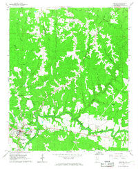
1967 Map of Hamilton
USGS Topo · Published 1968About this map
The Buttahatchee River meanders across the southern landscape of this 1960s Marion County survey, anchoring the development of Hamilton. The town shows its mid-century growth with the Marion County Hospital, a Drive-in Theater, and industrial features like the Sewage Disposal plant. This era represents a transition where traditional rural structures like the Shiloh Sch and numerous country churches, including New Hope Ch and Poplar Log Ch, remained central to the community fabric even as modern infrastructure expanded.
Find a feature on this map
61 named features on this map. Tap any name to fly to it.
Don’t see what you’re looking for? This feature index may not catch every label — zoom into the map to look around manually.
Map Details
Editions of this 1967 Hamilton Map
2 editions found
Other maps of this area

1936 · Hodges
USGS Topo · 1:24,000

1936 · South Of Hackleburg
USGS Topo · 1:24,000

1936 · Hackleburg
USGS Topo · 1:24,000

1936 · Vina
USGS Topo · 1:24,000

1946 · Hackleburg
USGS Topo · 1:24,000
1948 · Hackleburg
USGS Topo · 1:24,000

1949 · Hodges
USGS Topo · 1:24,000

1950 · Vina
USGS Topo · 1:24,000

1951 · Vina
USGS Topo · 1:24,000

1956 · Gadsden
USGS Topo · 1:250,000