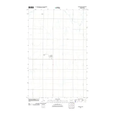
2011 Map of Hamilton
USGS Topo · Published 2011About this map
The small community of Hamilton serves as the focal point of this northern Red River Valley landscape, centered at the intersection of a vast grid of section roads. The map illustrates a strictly agricultural environment where the meandering Tongue River and the drainage of Big Slough provide the only natural interruptions to the geometric precision of the surrounding farmland. Genealogists and local historians will find the exact locations of the Hamilton Cemetery, situated just northwest of the town center, and the Bathgate Cemetery near the northern map boundary. The town’s layout is documented down to specific street names like Page Ave and North St, showing the settlement's compact footprint amid the expansive prairie. This survey captures the rural infrastructure of Pembina County as it existed in the early 21st century.
Find a feature on this map
22 named features on this map. Tap any name to fly to it.
Don’t see what you’re looking for? This feature index may not catch every label — zoom into the map to look around manually.
Map Details
Editions of this 2011 Hamilton Map
This is the sole edition of this map. No revisions or reprints were ever made.
Other maps of this area

1939 · Glasston
USGS Topo · 1:62,500

1939 · Cavalier
USGS Topo · 1:62,500

1941 · Glasston
USGS Topo · 1:62,500

1941 · Cavalier
USGS Topo · 1:62,500

1941 · Bathgate
USGS Topo · 1:62,500

1944 · Crystal
USGS Topo · 1:62,500

1952 · Thief River Falls
USGS Topo · 1:250,000

1956 · Thief River Falls
USGS Topo · 1:250,000

1957 · Thief River Falls
USGS Topo · 1:250,000

1964 · Neche
USGS Topo · 1:24,000