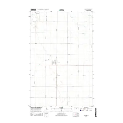
2014 Map of Hamilton
USGS Topo · Published 2014About this map
Hamilton serves as the central hub of this Red River Valley landscape, situated at the intersection of ND-5 and Highway 81. The settlement pattern follows a strict section-line grid, typical of the late 20th and early 21st-century agricultural plains. Waterways like the winding Tongue River and the low-lying Big Slough break the geometric precision of the fields. For those tracing family histories in Pembina County, the map identifies three distinct burial grounds: Saint Anthonys Cem in the north, Bathgate Cem nearby, and Hamilton Cem on the western edge of town. This survey illustrates the modern road network, including local connectors like 100th St NE and CR-4, which link the isolated farmsteads across the prairie.
Find a feature on this map
26 named features on this map. Tap any name to fly to it.
Don’t see what you’re looking for? This feature index may not catch every label — zoom into the map to look around manually.
Map Details
Editions of this 2014 Hamilton Map
This is the sole edition of this map. No revisions or reprints were ever made.
Other maps of this area

1939 · Glasston
USGS Topo · 1:62,500

1939 · Cavalier
USGS Topo · 1:62,500

1941 · Glasston
USGS Topo · 1:62,500

1941 · Cavalier
USGS Topo · 1:62,500

1941 · Bathgate
USGS Topo · 1:62,500

1944 · Crystal
USGS Topo · 1:62,500

1952 · Thief River Falls
USGS Topo · 1:250,000

1956 · Thief River Falls
USGS Topo · 1:250,000

1957 · Thief River Falls
USGS Topo · 1:250,000

1964 · Neche
USGS Topo · 1:24,000