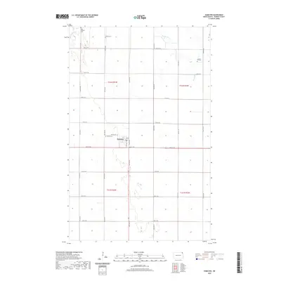
2020 Map of Hamilton
USGS Topo · Published 2020About this map
Hamilton serves as the primary settlement center of this eastern North Dakota landscape, situated within a grid of section lines and gravel roads. The town's small footprint is detailed down to its local street names, including Western Ave and Wall St. The surrounding countryside in Pembina County is primarily defined by its agricultural layout, punctuated by several burial grounds that offer significant genealogical value, such as Saint Anthonys Cem, Bathgate Cem, and the Adolph G Carl Cem to the east. The natural hydrology of the Red River Valley is visible through the meandering course of the Tongue River in the northwest and the drainage of the Big Slough. This modern survey reflects the enduring section-line road system that has dictated the region's geography since early settlement, providing a clear view of the area's contemporary rural structure.
Find a feature on this map
22 named features on this map. Tap any name to fly to it.
Don’t see what you’re looking for? This feature index may not catch every label — zoom into the map to look around manually.
Map Details
Editions of this 2020 Hamilton Map
This is the sole edition of this map. No revisions or reprints were ever made.
Other maps of this area

1939 · Glasston
USGS Topo · 1:62,500

1939 · Cavalier
USGS Topo · 1:62,500

1941 · Glasston
USGS Topo · 1:62,500

1941 · Cavalier
USGS Topo · 1:62,500

1941 · Bathgate
USGS Topo · 1:62,500

1944 · Crystal
USGS Topo · 1:62,500

1952 · Thief River Falls
USGS Topo · 1:250,000

1956 · Thief River Falls
USGS Topo · 1:250,000

1957 · Thief River Falls
USGS Topo · 1:250,000

1964 · Neche
USGS Topo · 1:24,000