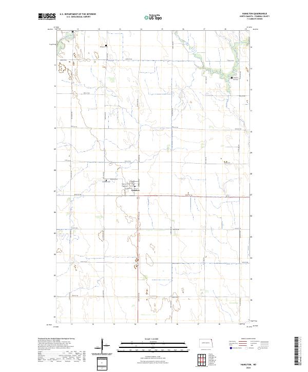
2024 Map of Hamilton
USGS Topo · Published 2024About this map
Hamilton serves as the primary hub of this Pembina County landscape, situated where Township Rd and 96th St NE meet. The settlement maintains a compact grid including Wall St and Page Ave, supported by a local Po. The surrounding terrain is defined by the meandering path of the Tongue River in the north and the drainage of the Big Slough to the east, illustrating the water-dependent layout of North Dakota's Red River Valley region. Genealogists will find significant value in the distribution of local burial sites, from the centrally located Hamilton Cem to the northern Bathgate Cem and the more isolated Adolph G Carl Cem near the river's edge. This modern survey documents a persistent rural structure where section lines dictate the road network, as seen in the long stretches of 149th Ave NE and 150th Ave NE.
Find a feature on this map
31 named features on this map. Tap any name to fly to it.
Don’t see what you’re looking for? This feature index may not catch every label — zoom into the map to look around manually.
Map Details
Editions of this 2024 Hamilton Map
This is the sole edition of this map. No revisions or reprints were ever made.
Other maps of this area

1939 · Glasston
USGS Topo · 1:62,500

1939 · Cavalier
USGS Topo · 1:62,500

1941 · Glasston
USGS Topo · 1:62,500

1941 · Cavalier
USGS Topo · 1:62,500

1941 · Bathgate
USGS Topo · 1:62,500

1944 · Crystal
USGS Topo · 1:62,500

1952 · Thief River Falls
USGS Topo · 1:250,000

1956 · Thief River Falls
USGS Topo · 1:250,000

1957 · Thief River Falls
USGS Topo · 1:250,000

1964 · Neche
USGS Topo · 1:24,000