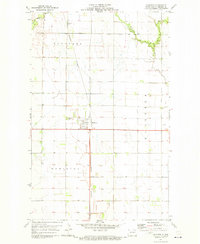
1971 Map of Hamilton
USGS Topo · Published 1973About this map
Hamilton serves as the central hub of this northern Red River Valley landscape, situated at the intersection of Highway 81 and the Burlington Northern railroad. The town plan is clearly defined by its local civic and social markers, including a townhall, a local fairground, and the Hamilton Cem on its northwestern edge. This 1971 survey captures the area's agricultural character, dominated by a grid of section lines and field boundaries within the townships of Bathgate, Carlisle, and Hamilton.
Find a feature on this map
14 named features on this map. Tap any name to fly to it.
Don’t see what you’re looking for? This feature index may not catch every label — zoom into the map to look around manually.
Map Details
Editions of this 1971 Hamilton Map
This is the sole edition of this map. No revisions or reprints were ever made.
Other maps of this area

1939 · Glasston
USGS Topo · 1:62,500

1939 · Cavalier
USGS Topo · 1:62,500

1941 · Glasston
USGS Topo · 1:62,500

1941 · Cavalier
USGS Topo · 1:62,500

1941 · Bathgate
USGS Topo · 1:62,500

1944 · Crystal
USGS Topo · 1:62,500

1952 · Thief River Falls
USGS Topo · 1:250,000

1956 · Thief River Falls
USGS Topo · 1:250,000

1957 · Thief River Falls
USGS Topo · 1:250,000

1964 · Neche
USGS Topo · 1:24,000