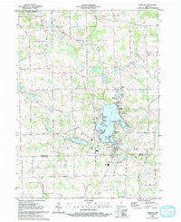
1992 Map of Hamilton
USGS Topo · Published 1993About this map
Hamilton Lake serves as the central focal point of this northeast Indiana landscape, its intricate shoreline dotted with lakeside developments like Cold Springs, Fountain Park, and Oakwood Shores. The settlement of Hamilton anchors the southern end of the lake, showing a concentrated grid of streets near the Gaging Station and local Cem. This 1990s record captures the region's character as a popular recreational destination, evidenced by numerous public access points such as Island Park and Forest Park, alongside established amenities like the local Golf Course.
Find a feature on this map
49 named features on this map. Tap any name to fly to it.
Don’t see what you’re looking for? This feature index may not catch every label — zoom into the map to look around manually.
Map Details
Editions of this 1992 Hamilton Map
This is the sole edition of this map. No revisions or reprints were ever made.
Other maps of this area

1939 · Hamilton
USGS Topo · 1:24,000

1939 · Angola East
USGS Topo · 1:24,000

1939 · Clear Lake
USGS Topo · 1:24,000

1940 · Metz
USGS Topo · 1:24,000

1940 · Clear Lake
USGS Topo · 1:24,000

1941 · Angola West
USGS Topo · 1:24,000

1942 · Ashley
USGS Topo · 1:24,000

1942 · Angola West
USGS Topo · 1:24,000

1947 · Angola East
USGS Topo · 1:24,000

1948 · Hamilton
USGS Topo · 1:24,000