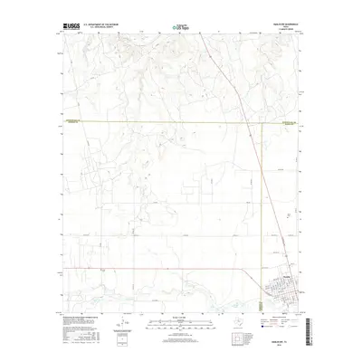
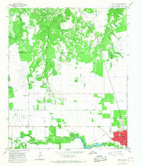
2016 Map of Hamlin NW
USGS Topo · Published 2016About this map
The rolling plains of West Texas converge at the intersection of Fisher, Jones, and Stonewall Counties, anchored by the settlement of Hamlin. This 2016 survey illustrates the modern grid of this agricultural hub, featuring street-level detail such as N Central Ave and W Lake Dr. The landscape is defined by the drainage systems of California Cr and Hitson Cr, which navigate the terrain alongside localized water sources like Moore Spring and Moore Lake. For those tracing local history or family heritage, the map identifies critical landmarks including Afton Cem to the west and North Cem near the town's northern edge. The network of county roads and farm-to-market routes, such as FM 540, underscores the area's rural connectivity and enduring ranching character.
Find a feature on this map
40 named features on this map. Tap any name to fly to it.
Don’t see what you’re looking for? This feature index may not catch every label — zoom into the map to look around manually.
Map Details
Editions of this 2016 Hamlin NW Map
This is the sole edition of this map. No revisions or reprints were ever made.
Other maps of this area

1893 · Roby
USGS Topo · 1:125,000

1931 · Rotan
USGS Topo · 1:62,500

1931 · Aspermont
USGS Topo · 1:62,500

1954 · Lubbock
USGS Topo · 1:250,000

1954 · Big Spring
USGS Topo · 1:250,000

1958 · Big Spring
USGS Topo · 1:250,000
1962 · Frog Mountain
USGS Topo · 1:24,000
1965 · Hamlin NE
USGS Topo · 1:24,000
1965 · Neinda
USGS Topo · 1:24,000
1965 · Hamlin NW
USGS Topo · 1:24,000