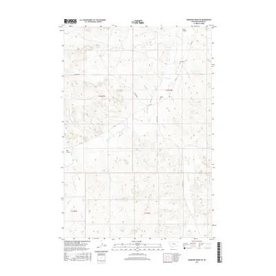
2017 Map of Hammond Draw SW
USGS Topo · Published 2017About this map
Rosebud Cr and its various tributaries, including Bean Cr and Greenleaf Cr, carve a complex drainage system through the landscape of Rosebud County. This 2017 survey shows a region defined by its hydrology and land management, with the survey boundaries of t1n r43e and t1s r43e overlaying the natural terrain. The map provides essential details for those researching local family history, noting the location of Bean Cem near Sand Coulee and Brown Cem further south. The transportation network is modest, consisting primarily of rural routes like Cowcreek Rd and Rte 447, which follow the contours of the coulees and creek beds. These roads connect the isolated cemeteries and water features, illustrating the sparse but deliberate human imprint on this part of the Montana interior.
Find a feature on this map
18 named features on this map. Tap any name to fly to it.
Don’t see what you’re looking for? This feature index may not catch every label — zoom into the map to look around manually.
Map Details
Editions of this 2017 Hammond Draw SW Map
This is the sole edition of this map. No revisions or reprints were ever made.
Other maps of this area

1954 · Hardin
USGS Topo · 1:250,000

1957 · Hardin
USGS Topo · 1:250,000

1958 · Hardin
USGS Topo · 1:250,000

1958 · Garfield Peak
USGS Topo · 1:24,000

1958 · Badger Peak
USGS Topo · 1:24,000

1966 · Ashland NE
USGS Topo · 1:24,000

1971 · Colstrip SE
USGS Topo · 1:24,000

1971 · Hammond Draw NW
USGS Topo · 1:24,000

1971 · Colstrip East
USGS Topo · 1:24,000

1971 · Hammond Draw
USGS Topo · 1:24,000