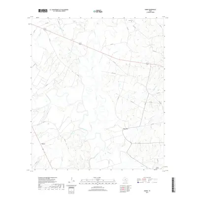
2019 Map of Hamon
USGS Topo · Published 2019About this map
The Guadalupe River meanders across this rural landscape, forming a complex network of tributaries and lowlands south of the Dilworth Cem. This 2019 survey documents the small settlements and agricultural infrastructure of Gonzales County, centering on Hamon and Glaze City. The terrain is defined by its drainage patterns, where Peach Cr and Elm Slough feed into the river valley, while Turkey Bottom marks the southern reach near the county line. The map reveals a land heavily partitioned by rural routes like FM 443 and FM 533, connecting isolated farmsteads and family properties. Smaller seasonal waterways such as Kokernot Br, Gelhorn Cr, and Freeman Cr carve through the landscape, illustrating the hydrological character of the region and providing critical reference points for local history and property research.
Find a feature on this map
39 named features on this map. Tap any name to fly to it.
Don’t see what you’re looking for? This feature index may not catch every label — zoom into the map to look around manually.
Map Details
Editions of this 2019 Hamon Map
This is the sole edition of this map. No revisions or reprints were ever made.
Other maps of this area

1901 · Flatonia
USGS Topo · 1:125,000

1953 · Seguin
USGS Topo · 1:250,000

1958 · Seguin
USGS Topo · 1:250,000

1959 · Hochheim
USGS Topo · 1:24,000

1959 · Gonzales South
USGS Topo · 1:24,000

1959 · Hamon
USGS Topo · 1:24,000

1960 · Cheapside
USGS Topo · 1:24,000

1962 · Dilworth
USGS Topo · 1:24,000
1962 · Gonzales North
USGS Topo · 1:24,000

1963 · Yoakum
USGS Topo · 1:24,000