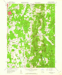
1958 Map of Hampden
USGS Topo · Published 1960About this map
Wilbraham Mountains dominate the central topography of this 1958 survey, forming a prominent north-south ridge that separates the growing residential areas of Springfield and Wilbraham from the more rural valley of the Scantic River to the east. The map records a landscape in transition, where institutional and community anchors like Wilbraham Academy and the State Game Farm sit alongside evidence of local industry at the Gravel Pit and Sand Pit.
Find a feature on this map
85 named features on this map. Tap any name to fly to it.
Don’t see what you’re looking for? This feature index may not catch every label — zoom into the map to look around manually.
Map Details
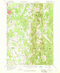
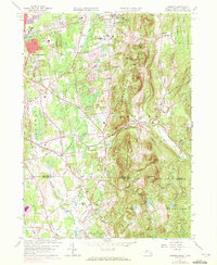
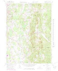
Editions of this 1958 Hampden Map
5 editions found

Other maps of this area

1886 · Springfield
USGS Topo · 1:62,500

1887 · Palmer
USGS Topo · 1:62,500

1889 · Springfield
USGS Topo · 1:62,500

1889 · Palmer
USGS Topo · 1:62,500

1892 · Hartford
USGS Topo · 1:62,500

1892 · Tolland
USGS Topo · 1:62,500

1893 · Springfield
USGS Topo · 1:62,500

1893 · Palmer
USGS Topo · 1:62,500

1895 · Springfield
USGS Topo · 1:62,500

1896 · Holyoke
USGS Topo · 1:125,000