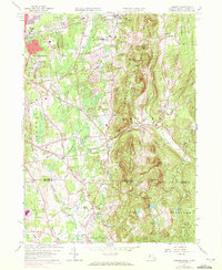
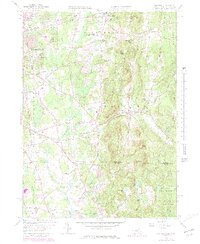
1958 Map of Hampden
USGS Topo · Published 1972About this map
Minnechoag Mountain and the ridge of Rattlesnake Peak dominate the landscape in this mid-century survey of the Massachusetts-Connecticut borderlands. The transition from the urban reach of Springfield to the more rural village of Hampden is evident, with suburban expansion marked in purple through areas like Sixteen Acres. In Wilbraham, historical institutions such as the Wilbraham Academy and Wilbraham Country Club provide local landmarks, while the State Game Farm reflects the conservation and recreational management of the era. South of the border, the terrain softens into the Somers and Stafford countryside, where the Scantic River flows through a landscape dotted with ponds like Cooley Pond and Worthington Pond. The presence of small settlements like Baptist Village and Mileoak Corner alongside numerous cemeteries, including Adams Cem and Old Cemetery, offers significant data for those tracing local family lineage in these cross-state communities.
Find a feature on this map
74 named features on this map. Tap any name to fly to it.
Don’t see what you’re looking for? This feature index may not catch every label — zoom into the map to look around manually.
Map Details
Editions of this 1958 Hampden Map
5 editions found
Other maps of this area

1886 · Springfield
USGS Topo · 1:62,500

1887 · Palmer
USGS Topo · 1:62,500

1889 · Springfield
USGS Topo · 1:62,500

1889 · Palmer
USGS Topo · 1:62,500

1892 · Hartford
USGS Topo · 1:62,500

1892 · Tolland
USGS Topo · 1:62,500

1893 · Springfield
USGS Topo · 1:62,500

1893 · Palmer
USGS Topo · 1:62,500

1895 · Springfield
USGS Topo · 1:62,500

1896 · Holyoke
USGS Topo · 1:125,000