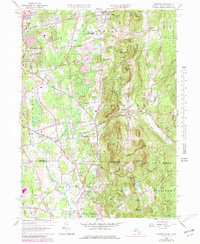
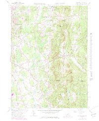
1958 Map of Hampden
USGS Topo · Published 1979About this map
The Scantic River valley anchors this mid-century portrait of the borderlands where Massachusetts and Connecticut meet. Centered on Hampden, the landscape is defined by the sharp rise of Minnechoag Mountain and Wigwam Hill, contrasting with the expanding residential clusters of Sixteen Acres and Baptist Village. The presence of the Wilbraham Academy and multiple local schools like Wilbraham Regional High Sch highlights the area's development as an educational and suburban hub.
Find a feature on this map
60 named features on this map. Tap any name to fly to it.
Don’t see what you’re looking for? This feature index may not catch every label — zoom into the map to look around manually.
Map Details
Editions of this 1958 Hampden Map
5 editions found
Other maps of this area

1886 · Springfield
USGS Topo · 1:62,500

1887 · Palmer
USGS Topo · 1:62,500

1889 · Springfield
USGS Topo · 1:62,500

1889 · Palmer
USGS Topo · 1:62,500

1892 · Hartford
USGS Topo · 1:62,500

1892 · Tolland
USGS Topo · 1:62,500

1893 · Springfield
USGS Topo · 1:62,500

1893 · Palmer
USGS Topo · 1:62,500

1895 · Springfield
USGS Topo · 1:62,500

1896 · Holyoke
USGS Topo · 1:125,000