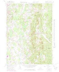
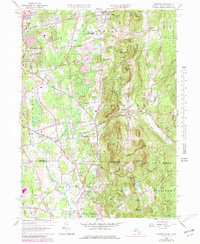
1958 Map of Hampden
USGS Topo · Published 1979About this map
The Wilbraham Mountains dominate this 1950s landscape, forming a prominent north-south ridge that separates the developed valley floors of Springfield from the rural uplands. This survey, updated with late-1970s aerial data, shows the expansion of residential neighborhoods in Sixteen Acres and the established campus of the St Wilbraham Academy. The terrain transitions from the suburban edges of East Longmeadow to the more dispersed settlements of Baptist Village and Mileoak Corner.
Find a feature on this map
95 named features on this map. Tap any name to fly to it.
Don’t see what you’re looking for? This feature index may not catch every label — zoom into the map to look around manually.
Map Details
Editions of this 1958 Hampden Map
5 editions found
Other maps of this area

1886 · Springfield
USGS Topo · 1:62,500

1887 · Palmer
USGS Topo · 1:62,500

1889 · Springfield
USGS Topo · 1:62,500

1889 · Palmer
USGS Topo · 1:62,500

1892 · Hartford
USGS Topo · 1:62,500

1892 · Tolland
USGS Topo · 1:62,500

1893 · Springfield
USGS Topo · 1:62,500

1893 · Palmer
USGS Topo · 1:62,500

1895 · Springfield
USGS Topo · 1:62,500

1896 · Holyoke
USGS Topo · 1:125,000