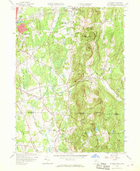
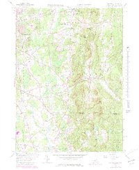
1958 Map of Hampden
USGS Topo · Published 1968About this map
The Wilbraham Mountains dominate the central topography of this mid-century survey, dividing the developing suburbs of eastern Springfield from the agricultural and institutional landscapes of Hampden and Wilbraham. In the north, the campus of Wilbraham Academy and the Wilbraham Regional High School anchor the community near Mileoak Corner. The landscape transitions from the residential street grids of Sixteen Acres to the more dispersed settlements of Baptist Village and North Somers, reflecting the era's suburban expansion into former farmland. Local industry and recreation are noted through features like the State Game Farm, the East Longmeadow Rod and Gun Club, and various gravel and sand pits. The southern portion of the map crosses into Connecticut, showing the rural character of Somers and Stafford near landmarks like Hall Hill and the Landing Field.
Find a feature on this map
91 named features on this map. Tap any name to fly to it.
Don’t see what you’re looking for? This feature index may not catch every label — zoom into the map to look around manually.
Map Details
Editions of this 1958 Hampden Map
5 editions found
Other maps of this area

1886 · Springfield
USGS Topo · 1:62,500

1887 · Palmer
USGS Topo · 1:62,500

1889 · Springfield
USGS Topo · 1:62,500

1889 · Palmer
USGS Topo · 1:62,500

1892 · Hartford
USGS Topo · 1:62,500

1892 · Tolland
USGS Topo · 1:62,500

1893 · Springfield
USGS Topo · 1:62,500

1893 · Palmer
USGS Topo · 1:62,500

1895 · Springfield
USGS Topo · 1:62,500

1896 · Holyoke
USGS Topo · 1:125,000