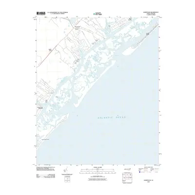
2010 Map of Hampstead
USGS Topo · Published 2010About this map
Hampstead and the surrounding coastline of Pender County are defined by a complex network of coastal waterways and landings at the dawn of the 21st century. The map illustrates a landscape where land and water are inextricably linked, featuring numerous access points such as Howard Landing, Bellamy Landing, and Old Point Landing along the marshy edges of Topsail Sound. The interior reveals a growing community with residential developments organized along roads like Forest Sound Rd and Peanut Rd, while the Hampstead Post Office serves as a central landmark for the town.
Find a feature on this map
41 named features on this map. Tap any name to fly to it.
Don’t see what you’re looking for? This feature index may not catch every label — zoom into the map to look around manually.
Map Details
Editions of this 2010 Hampstead Map
This is the sole edition of this map. No revisions or reprints were ever made.
Other maps of this area

1942 · Topsail
USGS Topo · 1:62,500

1942 · Wilmington
USGS Topo · 1:62,500

1947 · Rocky Point
USGS Topo · 1:62,500

1948 · Topsail
USGS Topo · 1:62,500

1948 · Wilmington
USGS Topo · 1:62,500

1953 · Beaufort
USGS Topo · 1:250,000

1954 · Beaufort
USGS Topo · 1:250,000

1970 · Hampstead
USGS Topo · 1:24,000
1970 · Wrightsville Beach
USGS Topo · 1:24,000

1970 · Topsail
USGS Topo · 1:24,000