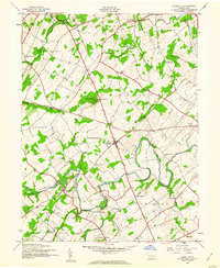
1944 Map of Hampton
USGS Topo · Published 1960About this map
York Sulphur Springs and the village of Hampton anchor this mid-1940s landscape in rural Adams County. The map reveals an exceptionally dense network of local education, including a series of small rural institutions such as Seven Hundred Sch, Two Churches Sch, and Independence Sch. These small schoolhouses, spaced just a few miles apart, suggest the decentralized nature of rural life and community organization before the era of major district consolidation.
Find a feature on this map
42 named features on this map. Tap any name to fly to it.
Don’t see what you’re looking for? This feature index may not catch every label — zoom into the map to look around manually.
Map Details
Editions of this 1944 Hampton Map
5 editions found

Other maps of this area

1904 · Carlisle
USGS Topo · 1:62,500

1906 · New Cumberland
USGS Topo · 1:62,500

1908 · Gettysburg
USGS Topo · 1:62,500

1920 · Hanover
USGS Topo · 1:62,500

1922 · Hanover
USGS Topo · 1:62,500

1942 · Gettysburg
USGS Topo · 1:125,000

1943 · New Cumberland
USGS Topo · 1:62,500

1943 · Carlisle
USGS Topo · 1:62,500

1944 · Gettysburg
USGS Topo · 1:31,680

1944 · Mc Sherrystown
USGS Topo · 1:31,680
Featured Places
- Latimore Township, PA
- Huntington Township, PA
- Mount Pleasant Township, PA
- Hamilton Township, PA
- Oxford Township, PA