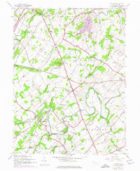
1944 Map of Hampton
USGS Topo · Published 1975About this map
York Sulphur Springs and the village of Hampton anchor this mid-century look at the rural landscape along the border of Adams and York counties. The topography is defined by the winding course of Conewago Creek and its many tributaries, including Bermudian Creek and Mud Run. This 1944 survey, later updated with 1970s aerial data, reveals a high density of rural schoolhouses, many likely defunct by the time of the revision, such as Victory Sch, Oakwood Sch, and the uniquely named Seven Hundred Sch.
Find a feature on this map
41 named features on this map. Tap any name to fly to it.
Don’t see what you’re looking for? This feature index may not catch every label — zoom into the map to look around manually.
Map Details
Editions of this 1944 Hampton Map
5 editions found

Other maps of this area

1904 · Carlisle
USGS Topo · 1:62,500

1906 · New Cumberland
USGS Topo · 1:62,500

1908 · Gettysburg
USGS Topo · 1:62,500

1920 · Hanover
USGS Topo · 1:62,500

1922 · Hanover
USGS Topo · 1:62,500

1942 · Gettysburg
USGS Topo · 1:125,000

1943 · New Cumberland
USGS Topo · 1:62,500

1943 · Carlisle
USGS Topo · 1:62,500

1944 · Gettysburg
USGS Topo · 1:31,680

1944 · Mc Sherrystown
USGS Topo · 1:31,680
Featured Places
- Latimore Township, PA
- Huntington Township, PA
- Mount Pleasant Township, PA
- Hamilton Township, PA
- Oxford Township, PA