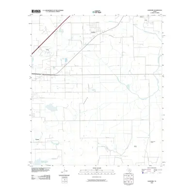
2010 Map of Hamshire
USGS Topo · Published 2010About this map
Hamshire serves as the primary hub in this Jefferson County landscape, where the coastal prairie is defined by a dense network of energy infrastructure and water drainage. The terrain is notably marked by extensive petroleum extraction sites, including the Stowell Oil Field, South Stowell Oil Field, and the Big Hill Oil Field, reflecting the region's long-standing industrial character.
Find a feature on this map
38 named features on this map. Tap any name to fly to it.
Don’t see what you’re looking for? This feature index may not catch every label — zoom into the map to look around manually.
Map Details
Editions of this 2010 Hamshire Map
This is the sole edition of this map. No revisions or reprints were ever made.
Other maps of this area

1943 · Sea Breeze
USGS Topo · 1:24,000

1943 · Stowell
USGS Topo · 1:24,000

1943 · Fannett East
USGS Topo · 1:24,000

1945 · Fannett East
USGS Topo · 1:31,680

1945 · Nolte
USGS Topo · 1:31,680

1945 · Sea Breeze
USGS Topo · 1:31,680

1950 · Houston
USGS Topo · 1:250,000

1956 · Houston
USGS Topo · 1:250,000

1961 · Star Lake
USGS Topo · 1:24,000
1962 · Stanolind Reservoir
USGS Topo · 1:24,000