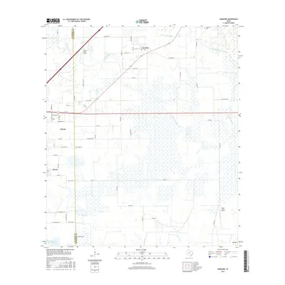
2016 Map of Hamshire
USGS Topo · Published 2016About this map
Low-lying coastal plains and extensive wetland networks define this landscape on the border of Chambers and Jefferson counties. The settlements of Hamshire, Winnie, and Stowell cluster in the western and northern sections, connected by a grid of local roads including FM 1406 and SHF 3 W. Significant drainage features like Mayhaw Bayou and the S Fork Taylor Bayou wind through the marshy terrain, which is punctuated by topographical markers such as Big Hill. Historical land use is evident in the presence of the Woodrow Cem and aviation landmarks like the Griffith Ranch Airport and Wilber Farms Airport, suggesting a mix of agricultural operations and rural infrastructure typical of this Gulf Coast region.
Find a feature on this map
61 named features on this map. Tap any name to fly to it.
Don’t see what you’re looking for? This feature index may not catch every label — zoom into the map to look around manually.
Map Details
Editions of this 2016 Hamshire Map
This is the sole edition of this map. No revisions or reprints were ever made.
Other maps of this area

1943 · Sea Breeze
USGS Topo · 1:24,000

1943 · Stowell
USGS Topo · 1:24,000

1943 · Fannett East
USGS Topo · 1:24,000

1945 · Fannett East
USGS Topo · 1:31,680

1945 · Nolte
USGS Topo · 1:31,680

1945 · Sea Breeze
USGS Topo · 1:31,680

1950 · Houston
USGS Topo · 1:250,000

1956 · Houston
USGS Topo · 1:250,000

1961 · Star Lake
USGS Topo · 1:24,000
1962 · Stanolind Reservoir
USGS Topo · 1:24,000