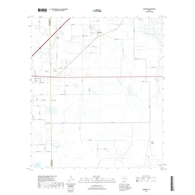
2019 Map of Hamshire
USGS Topo · Published 2019About this map
The settlement of Hamshire serves as the focal point of this coastal prairie landscape along the Chambers and Jefferson county line. The terrain is defined by a complex network of drainage systems, including Mayhaw Bayou and the meandering South Fork Taylor Bayou, which shape the agricultural and ranching patterns of the region. Local land use is characterized by large estates and aviation interests, evidenced by the presence of the Griffith Ranch Airport and Wilber Farms Airport. To the north, the Woodrow Cem provides a point of genealogical interest, while the elevation at Big Hill stands out against the surrounding wetlands. This survey illustrates the modern road grid, where historic routes like Old Big Hill Rd and Hamshire Rd connect scattered farmsteads across the marshy Texas lowlands.
Find a feature on this map
59 named features on this map. Tap any name to fly to it.
Don’t see what you’re looking for? This feature index may not catch every label — zoom into the map to look around manually.
Map Details
Editions of this 2019 Hamshire Map
This is the sole edition of this map. No revisions or reprints were ever made.
Other maps of this area

1943 · Sea Breeze
USGS Topo · 1:24,000

1943 · Stowell
USGS Topo · 1:24,000

1943 · Fannett East
USGS Topo · 1:24,000

1945 · Fannett East
USGS Topo · 1:31,680

1945 · Nolte
USGS Topo · 1:31,680

1945 · Sea Breeze
USGS Topo · 1:31,680

1950 · Houston
USGS Topo · 1:250,000

1956 · Houston
USGS Topo · 1:250,000

1961 · Star Lake
USGS Topo · 1:24,000
1962 · Stanolind Reservoir
USGS Topo · 1:24,000