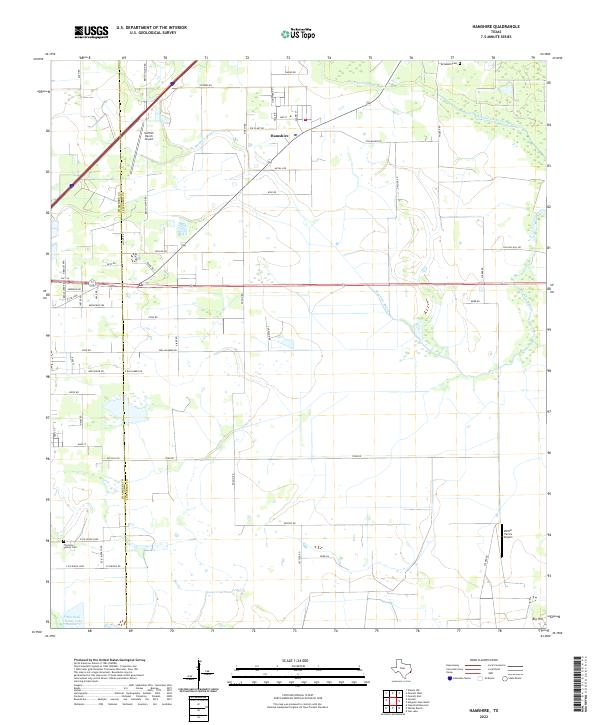
2022 Map of Hamshire
USGS Topo · Published 2022About this map
The coastal prairie of the Chambers Co and Jefferson Co border is defined by a network of drainage bayous and small settlements. The community of Hamshire serves as a local hub, situated near the headwaters of Mayhaw Bayou and the winding course of the S Fork Taylor Bayou. The landscape is largely agricultural, marked by several private landing strips such as Griffith Ranch Airport and Wilber Farms Airport, reflecting the region's reliance on aerial support for ranching and farming operations.
Find a feature on this map
59 named features on this map. Tap any name to fly to it.
Don’t see what you’re looking for? This feature index may not catch every label — zoom into the map to look around manually.
Map Details
Editions of this 2022 Hamshire Map
This is the sole edition of this map. No revisions or reprints were ever made.
Other maps of this area

1943 · Sea Breeze
USGS Topo · 1:24,000

1943 · Stowell
USGS Topo · 1:24,000

1943 · Fannett East
USGS Topo · 1:24,000

1945 · Fannett East
USGS Topo · 1:31,680

1945 · Nolte
USGS Topo · 1:31,680

1945 · Sea Breeze
USGS Topo · 1:31,680

1950 · Houston
USGS Topo · 1:250,000

1956 · Houston
USGS Topo · 1:250,000

1961 · Star Lake
USGS Topo · 1:24,000
1962 · Stanolind Reservoir
USGS Topo · 1:24,000