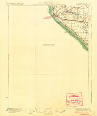
1932 Map of Hannibal
USGS Topo · Published 1932About this map
Mississippi River bottomlands define the geography of this 1932 survey, illustrating the complex relationship between the water and the low-lying terrain of Marion and Pike counties. While the city of Hannibal sits on the western bank, the eastern floodplains in Illinois are a network of seasonal water bodies and drainage features like Bird Slough, The Sny, and Running Slough. This environment necessitated a decentralized social structure, evidenced by the numerous rural schoolhouses such as Eagle Slough Sch and Rouse Sch that served isolated farmstead communities.
Find a feature on this map
35 named features on this map. Tap any name to fly to it.
Don’t see what you’re looking for? This feature index may not catch every label — zoom into the map to look around manually.
Map Details
Editions of this 1932 Hannibal Map
4 editions found
Other maps of this area

1890 · Louisiana
USGS Topo · 1:125,000

1890 · Mexico
USGS Topo · 1:125,000

1903 · Palmyra
USGS Topo · 1:125,000

1925 · Quincy
USGS Topo · 1:62,500

1925 · Liberty
USGS Topo · 1:62,500

1927 · Liberty
USGS Topo · 1:62,500

1931 · Barry
USGS Topo · 1:62,500

1932 · Hannibal
USGS Topo · 1:62,500

1936 · Hannibal
USGS Topo · 1:48,000

1936 · Barry
USGS Topo · 1:48,000