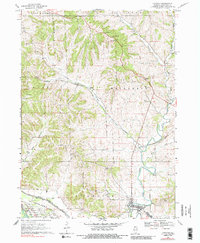
1968 Map of Hanover
USGS Topo · Published 1988About this map
The Apple River snakes through the landscape of Jo Daviess County, defining the valley that contains the village of Hanover and the nearby settlement of North Hanover. During the late 1960s, this area remained deeply tied to its industrial and agricultural roots, evidenced by several quarries and the expansive grounds of the Savanna Army Depot occupying the southern reaches. The map documents a complex transport network where the Chicago and North Western and Chicago Burlington and Quincy railroads navigate the steep ravines of Irish Hollow and Snipe Hollow. For genealogists, the survey identifies several small rural burial grounds including Weston Cem and the Log Church Cem, alongside remnants of earlier communities at Rodden and Winston.
Find a feature on this map
30 named features on this map. Tap any name to fly to it.
Don’t see what you’re looking for? This feature index may not catch every label — zoom into the map to look around manually.
Map Details
Editions of this 1968 Hanover Map
3 editions found
Other maps of this area

1892 · Savanna
USGS Topo · 1:62,500

1911 · Elizabeth
USGS Topo · 1:62,500

1911 · Galena
USGS Topo · 1:62,500

1913 · Galena
USGS Topo · 1:62,500

1935 · Miles
USGS Topo · 1:62,500

1936 · Elizabeth
USGS Topo · 1:62,500

1941 · Miles
USGS Topo · 1:62,500

1952 · Savanna
USGS Topo · 1:62,500

1953 · Blackhawk
USGS Topo · 1:24,000

1953 · Green Island
USGS Topo · 1:24,000