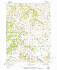
1968 Map of Hanover
USGS Topo · Published 1988About this map
Apple River carves a deep path through the driftless-area topography of Jo Daviess County, defining the settlement patterns of Hanover and its northern neighbors. The landscape is characterized by prominent drainage systems like Irish Hollow and Long Hollow, which dictated the winding route of the Chicago and North Western railroad as it navigated the hills between Winston and Rodden. In the southern portion of the quadrangle, the industrial and military footprint is evident at the edge of the Savanna Army Depot, while the upland ridges preserve older community markers such as the Log Church Cem and Weston Cem. These sites, along with a rural Townhall and scattered quarry operations, reflect a mid-century economy balanced between small-town infrastructure and the heavy logistical presence of the nearby military installation.
Find a feature on this map
26 named features on this map. Tap any name to fly to it.
Don’t see what you’re looking for? This feature index may not catch every label — zoom into the map to look around manually.
Map Details
Editions of this 1968 Hanover Map
3 editions found
Other maps of this area

1892 · Savanna
USGS Topo · 1:62,500

1911 · Elizabeth
USGS Topo · 1:62,500

1911 · Galena
USGS Topo · 1:62,500

1913 · Galena
USGS Topo · 1:62,500

1935 · Miles
USGS Topo · 1:62,500

1936 · Elizabeth
USGS Topo · 1:62,500

1941 · Miles
USGS Topo · 1:62,500

1952 · Savanna
USGS Topo · 1:62,500

1953 · Blackhawk
USGS Topo · 1:24,000

1953 · Green Island
USGS Topo · 1:24,000