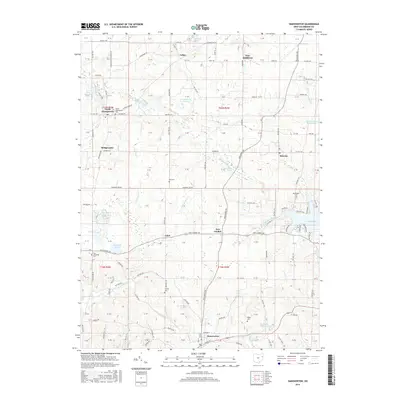
2016 Map of Hanoverton
USGS Topo · Published 2016About this map
Hanoverton and the surrounding Columbiana County landscape are defined by a complex network of small settlements and aquatic features in this mid-2010s survey. The area transitions from the structured township grids of North Georgetown and Winona to the more varied terrain around Guilford Lake and Slates Reservoir. Genealogists will find a wealth of family history sites, with numerous burial grounds such as New Alexander Cem, King Cem, and Figley Cem distributed across the countryside.
Find a feature on this map
104 named features on this map. Tap any name to fly to it.
Don’t see what you’re looking for? This feature index may not catch every label — zoom into the map to look around manually.
Map Details
Editions of this 2016 Hanoverton Map
This is the sole edition of this map. No revisions or reprints were ever made.
Other maps of this area

1905 · Salineville
USGS Topo · 1:62,500

1909 · Alliance
USGS Topo · 1:62,500

1909 · Lisbon
USGS Topo · 1:62,500

1910 · Carrollton
USGS Topo · 1:62,500

1912 · Carrollton
USGS Topo · 1:62,500

1951 · Canton
USGS Topo · 1:250,000

1952 · Alliance
USGS Topo · 1:24,000

1952 · Damascus
USGS Topo · 1:24,000
1952 · Salem
USGS Topo · 1:24,000

1953 · Canton
USGS Topo · 1:250,000