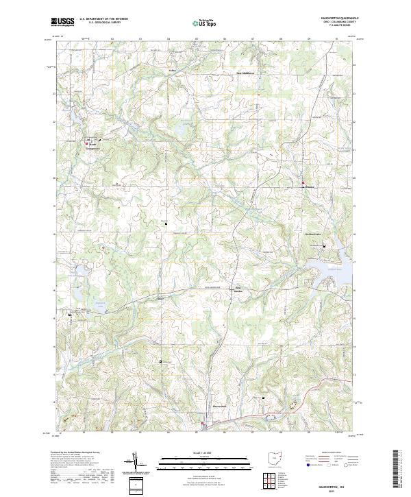
2023 Map of Hanoverton
USGS Topo · Published 2023About this map
Hanoverton and the surrounding townships of Columbiana County are detailed in this modern survey, revealing a landscape defined by its historical settlements and intricate water systems. The Mahoning River meanders through the northern section, feeding into Watercress Marsh, while the southern reaches are shaped by the West Fork Little Beaver Creek and the expansive Guilford Lake. Small hamlets like North Georgetown, Winona, and New Garden anchor the rural road network, which is dotted with lineage-rich landmarks including Woodside Cem and Dutton Cem.
Find a feature on this map
100 named features on this map. Tap any name to fly to it.
Don’t see what you’re looking for? This feature index may not catch every label — zoom into the map to look around manually.
Map Details
Editions of this 2023 Hanoverton Map
This is the sole edition of this map. No revisions or reprints were ever made.
Other maps of this area

1905 · Salineville
USGS Topo · 1:62,500

1909 · Alliance
USGS Topo · 1:62,500

1909 · Lisbon
USGS Topo · 1:62,500

1910 · Carrollton
USGS Topo · 1:62,500

1912 · Carrollton
USGS Topo · 1:62,500

1951 · Canton
USGS Topo · 1:250,000

1952 · Alliance
USGS Topo · 1:24,000

1952 · Damascus
USGS Topo · 1:24,000
1952 · Salem
USGS Topo · 1:24,000

1953 · Canton
USGS Topo · 1:250,000