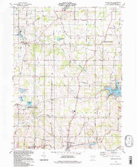
1994 Map of Hanoverton
USGS Topo · Published 1997About this map
Hanoverton and the surrounding townships of Columbiana and Mahoning Counties are shown here during a period of agricultural stability and managed conservation. The landscape is defined by the transition from rural farming tracts to dedicated state lands, most notably the Guilford Lake State Reserve and the Zepernick Lake State Wildlife Area. This mapping preserves the location of historic crossroads communities like North Georgetown, Winona, and New Garden, which remain connected by a dense grid of family-named roads such as Carey Road and Whinnery Road. Cultural history is anchored by several burial grounds, including King Cem and Woodsdale Cem, alongside the centralized United Schools complex. Small-scale industrial activity is evident through various Strip Mine sites and a scattered network of gas and oil wells, illustrating the region's reliance on both the soil and the resources beneath it.
Find a feature on this map
69 named features on this map. Tap any name to fly to it.
Don’t see what you’re looking for? This feature index may not catch every label — zoom into the map to look around manually.
Map Details
Editions of this 1994 Hanoverton Map
This is the sole edition of this map. No revisions or reprints were ever made.
Other maps of this area

1905 · Salineville
USGS Topo · 1:62,500

1909 · Alliance
USGS Topo · 1:62,500

1909 · Lisbon
USGS Topo · 1:62,500

1910 · Carrollton
USGS Topo · 1:62,500

1912 · Carrollton
USGS Topo · 1:62,500

1951 · Canton
USGS Topo · 1:250,000

1952 · Alliance
USGS Topo · 1:24,000

1952 · Damascus
USGS Topo · 1:24,000
1952 · Salem
USGS Topo · 1:24,000

1953 · Canton
USGS Topo · 1:250,000