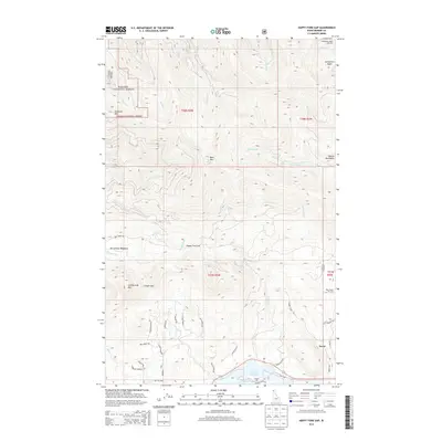
2013 Map of Happy Fork Gap
USGS Topo · Published 2013About this map
Kanisku National Forest dominates the northwestern portion of this landscape, where high peaks like Gisborne Mtn and Bald Mtn overlook the steep drainages of Uleda Cr and Devils Cr. The rugged terrain of the Selkirk Mountains transitions into recreational corridors at the Schweitzer Basin Ski Area and Pine Street Ski Area. In the south, the settlement of Dover sits near the shores of Lake Pend Oreille, where the land levels out into residential pockets such as Wooded Acres and The Willows.
Find a feature on this map
90 named features on this map. Tap any name to fly to it.
Don’t see what you’re looking for? This feature index may not catch every label — zoom into the map to look around manually.
Map Details
Editions of this 2013 Happy Fork Gap Map
This is the sole edition of this map. No revisions or reprints were ever made.
Other maps of this area

1901 · Sandpoint
USGS Topo · 1:125,000

1911 · Priest Lake
USGS Topo · 1:250,000

1911 · Sandpoint
USGS Topo · 1:125,000

1913 · Priest Lake
USGS Topo · 1:250,000

1958 · Sandpoint
USGS Topo · 1:250,000

1963 · Sandpoint
USGS Topo · 1:250,000

1967 · Coolin
USGS Topo · 1:24,000

1967 · Prater Mtn
USGS Topo · 1:24,000
1968 · Happy Fork Gap
USGS Topo · 1:24,000
1968 · Morton
USGS Topo · 1:24,000