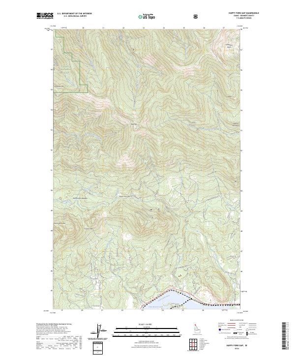
2024 Map of Happy Fork Gap
USGS Topo · Published 2024About this map
The Pend Oreille River flows along the southern edge of this Idaho landscape, where the settlement of Dover and the residential area of The Willows meet the water. This terrain is dominated by the steep southern rises of the Selkirk Mountains, including Bald Mtn and Gisborne Mtn. Much of the northwest is within the Kaniksu National Forest, a region defined by narrow drainages like Canyon Creek and high meadows such as McCormack Meadows.
Find a feature on this map
65 named features on this map. Tap any name to fly to it.
Don’t see what you’re looking for? This feature index may not catch every label — zoom into the map to look around manually.
Map Details
Editions of this 2024 Happy Fork Gap Map
This is the sole edition of this map. No revisions or reprints were ever made.
Other maps of this area

1901 · Sandpoint
USGS Topo · 1:125,000

1911 · Priest Lake
USGS Topo · 1:250,000

1911 · Sandpoint
USGS Topo · 1:125,000

1913 · Priest Lake
USGS Topo · 1:250,000

1958 · Sandpoint
USGS Topo · 1:250,000

1963 · Sandpoint
USGS Topo · 1:250,000

1967 · Coolin
USGS Topo · 1:24,000

1967 · Prater Mtn
USGS Topo · 1:24,000
1968 · Happy Fork Gap
USGS Topo · 1:24,000
1968 · Morton
USGS Topo · 1:24,000