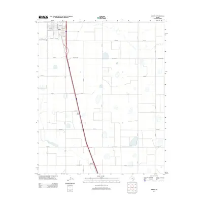
2012 Map of Happy
USGS Topo · Published 2012About this map
Happy anchors the northern edge of this High Plains landscape, where a precise grid of streets and county roads facilitates the region's agricultural transport network. The town's layout includes central arteries like E Main St and W Northern St, with the Happy Cem situated to the southwest along Ranch Road 1075. This area of Swisher County is defined by its playa lakes—natural seasonal depressions that dot the terrain between the straight-line paths of Co Rd 9 and Co Rd 13.
Find a feature on this map
38 named features on this map. Tap any name to fly to it.
Don’t see what you’re looking for? This feature index may not catch every label — zoom into the map to look around manually.
Map Details
Editions of this 2012 Happy Map
This is the sole edition of this map. No revisions or reprints were ever made.
Other maps of this area

1954 · Plainview
USGS Topo · 1:250,000

1958 · Plainview
USGS Topo · 1:250,000

1960 · Canyon
USGS Topo · 1:62,500

1960 · Wayside
USGS Topo · 1:62,500

1965 · Tulia
USGS Topo · 1:24,000

1965 · Lakeview
USGS Topo · 1:24,000

1965 · Happy
USGS Topo · 1:24,000

1966 · Tulia NW
USGS Topo · 1:24,000

1968 · Tule Lake
USGS Topo · 1:24,000

1969 · Tule Lake NW
USGS Topo · 1:24,000