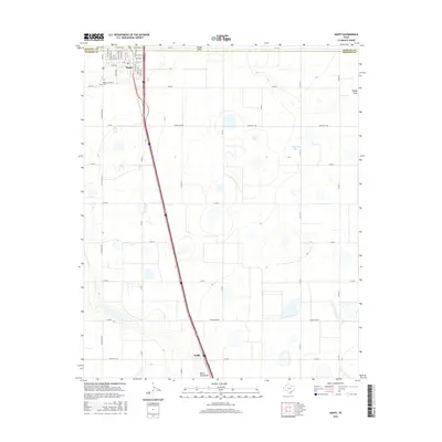
2016 Map of Happy
USGS Topo · Published 2016About this map
Happy sits prominently at the intersection of the Randall and Swisher County line in this 2016 survey of the Texas Panhandle. The town’s grid is clearly defined by streets such as E Main St and S White Ave, while a local Cem is located just west of the main settlement. The surrounding High Plains landscape is characterized by its agricultural layout and several seasonal water features, including Happy Draw to the north and North Tule Draw at the southern edge. The small settlement of Kaffir is positioned further south along the primary highway corridor that bisects the region. The map reveals a highly structured environment where ranch roads like Ranch RD 1881 and numerous county roads serve a series of natural basins and playa-like formations such as Singleton Lake.
Find a feature on this map
45 named features on this map. Tap any name to fly to it.
Don’t see what you’re looking for? This feature index may not catch every label — zoom into the map to look around manually.
Map Details
Editions of this 2016 Happy Map
This is the sole edition of this map. No revisions or reprints were ever made.
Other maps of this area

1954 · Plainview
USGS Topo · 1:250,000

1958 · Plainview
USGS Topo · 1:250,000

1960 · Canyon
USGS Topo · 1:62,500

1960 · Wayside
USGS Topo · 1:62,500

1965 · Tulia
USGS Topo · 1:24,000

1965 · Lakeview
USGS Topo · 1:24,000

1965 · Happy
USGS Topo · 1:24,000

1966 · Tulia NW
USGS Topo · 1:24,000

1968 · Tule Lake
USGS Topo · 1:24,000

1969 · Tule Lake NW
USGS Topo · 1:24,000