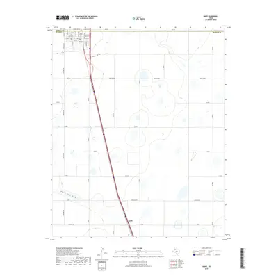
2019 Map of Happy
USGS Topo · Published 2019About this map
Happy sits prominently along the county line between Randall and Swisher counties, serving as the primary hub for this portion of the Texas Panhandle. The town's grid is detailed with numerous street names such as W Main and E Main St, while Happy Cem is located just southwest of the main settlement. The landscape is characterized by its agricultural layout and natural drainage patterns, most notably Happy Draw which winds northeastward away from the town, and North Tule Draw in the southern portion of the sheet. Outside the main town, the settlement of Kaffir is identified further south along the primary transportation corridor. The map reveals a high density of rural infrastructure, including FM 1075 and several regional routes like Ranch Rd 1881 that connect isolated farmsteads across the high plains.
Find a feature on this map
44 named features on this map. Tap any name to fly to it.
Don’t see what you’re looking for? This feature index may not catch every label — zoom into the map to look around manually.
Map Details
Editions of this 2019 Happy Map
This is the sole edition of this map. No revisions or reprints were ever made.
Other maps of this area

1954 · Plainview
USGS Topo · 1:250,000

1958 · Plainview
USGS Topo · 1:250,000

1960 · Canyon
USGS Topo · 1:62,500

1960 · Wayside
USGS Topo · 1:62,500

1965 · Tulia
USGS Topo · 1:24,000

1965 · Lakeview
USGS Topo · 1:24,000

1965 · Happy
USGS Topo · 1:24,000

1966 · Tulia NW
USGS Topo · 1:24,000

1968 · Tule Lake
USGS Topo · 1:24,000

1969 · Tule Lake NW
USGS Topo · 1:24,000