
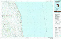
1984 Map of Harbor Beach
USGS Topo · Published 1985About this map
The agricultural thumb of Michigan is defined by a dense network of man-made drainage systems like Baranski Drain and Cramp Drain that support the fertile plains between Bad Axe and the Lake Huron shoreline. Along the coast, maritime history is anchored by the Lighthouse at Harbor Beach and prominent landmarks like White Rock and Hardwood Point. The interior landscape reveals the significant footprint of the Minden City State Game Area, which includes a notable Peat Bog, alongside the Sanilac State Game Area. Industrial and transportation infrastructure of the mid-1980s is clearly visible through the Chesapeake and Ohio railroad line and small aviation hubs such as the Huron County Memorial Airport and Neuman Landing Field. Small lakeside and inland settlements, including Port Hope, Forestville, and Deckerville, are mapped alongside family-named landmarks like Hallway Corners.
Find a feature on this map
133 named features on this map. Tap any name to fly to it.
Don’t see what you’re looking for? This feature index may not catch every label — zoom into the map to look around manually.
Map Details
Editions of this 1984 Harbor Beach Map
2 editions found
Other maps of this area

1954 · Flint
USGS Topo · 1:250,000

1954 · Tawas City
USGS Topo · 1:250,000

1958 · Flint
USGS Topo · 1:250,000

1958 · Tawas City
USGS Topo · 1:250,000

1963 · Snover
USGS Topo · 1:24,000

1963 · Forestville
USGS Topo · 1:24,000

1963 · Ruth
USGS Topo · 1:24,000

1963 · New Greenleaf
USGS Topo · 1:24,000

1963 · Sandusky
USGS Topo · 1:24,000

1963 · Ubly
USGS Topo · 1:24,000