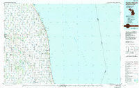
1984 Map of Harbor Beach
USGS Topo · Published 1991About this map
The agricultural thumb of Michigan meets the expanse of Lake Huron in this detailed 1980s-era survey. The county seat of Bad Axe stands as a primary hub in the northwest, supported by infrastructure like the Huron County Memorial Airport and a dense network of local township roads and drains such as Sigel Drain and Lincoln Drain. This landscape is defined by its rectilinear township grid, which organizes the numerous small farming communities like Verona, Parisville, and Rapson.
Find a feature on this map
118 named features on this map. Tap any name to fly to it.
Don’t see what you’re looking for? This feature index may not catch every label — zoom into the map to look around manually.
Map Details
Editions of this 1984 Harbor Beach Map
2 editions found

Other maps of this area

1954 · Flint
USGS Topo · 1:250,000

1954 · Tawas City
USGS Topo · 1:250,000

1958 · Flint
USGS Topo · 1:250,000

1958 · Tawas City
USGS Topo · 1:250,000

1963 · Snover
USGS Topo · 1:24,000

1963 · Forestville
USGS Topo · 1:24,000

1963 · Ruth
USGS Topo · 1:24,000

1963 · New Greenleaf
USGS Topo · 1:24,000

1963 · Sandusky
USGS Topo · 1:24,000

1963 · Ubly
USGS Topo · 1:24,000