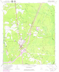
1962 Map of Hardeeville
USGS Topo · Published 1979About this map
Hardeeville serves as the focal point of this Lowcountry survey, where the Southern and Seaboard Coast Line railroads intersect. The landscape is defined by an extensive network of wetlands, including the Fourmile Swamp and Great Swamp, which frame the local geography between the Savannah River and the New River. Small settlements and river access points like Purysburg Landing and Mill Stone Landing highlight the historic importance of the river for transport and commerce.
Find a feature on this map
70 named features on this map. Tap any name to fly to it.
Don’t see what you’re looking for? This feature index may not catch every label — zoom into the map to look around manually.
Map Details
Editions of this 1962 Hardeeville Map
4 editions found
Other maps of this area

1920 · Hardeeville
USGS Topo · 1:62,500

1920 · Okatie
USGS Topo · 1:62,500

1920 · Bluffton
USGS Topo · 1:62,500

1942 · Savannah
USGS Topo · 1:62,500

1942 · Okatie
USGS Topo · 1:62,500

1943 · Hardeeville
USGS Topo · 1:62,500

1945 · Bluffton
USGS Topo · 1:62,500

1947 · Savannah
USGS Topo · 1:250,000

1948 · Savannah
USGS Topo · 1:250,000

1953 · Hardeeville
USGS Topo · 1:62,500